Postingan

Menampilkan postingan dari Desember, 2016

Measuring whell CLL400

Gambar
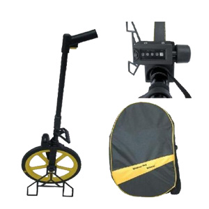
Rp Hubungi Kami @ Measuring whell CLL400 Rubber wheel,aluminum foldable handle. Precision counter with wheel braker. Circumference of wheel:1m Measuring range:9999.9m,CM can be read out from the wheel. Comes with carry bag Weight:2.5kg.

Automatic level nikon AX-2S

Gambar
Rp Hubungi Kami @ Jual sewa service kalibrasi automatic level / waterpass nikon AX-2S The Nikon AX-2S is compact and lightweight with water-resistant construction. It features a magnetic-dampened automatic compensator. The horizontal tangent knobs allow for unlimited range and smooth, precise pointing Nikon Automatic Level AX-2S •    Magnification: 20 x •    Accuracy*: ± 2.5 mm •    Aperture: 30 mm •    Shortest focus: 0.75 m] •    Compensator : Magnetic dampened Spesifikasi - Nikon AX-2S Automatic Level Telescope - Tube length: 7.5? (190 mm); Image: Erect; Effective diameter of objective lens: 1.2? (30 mm); Magnification: 20x; Field of view: 1°30' (2.6' at 100'); Resolution power: 3.5?; Minimum focusing distance: 2.46' (.75 m); Stadia ratio: 1:100. Automatic compensator - Type: Wire-hung, air damper; Setting accuracy: ±0.5?; Range: ±16'. Level vial sensitivity - Circular level: 10'/2 mm. Standard deviation (1-km double-run leveling) - Without micrometer: ±2.0 m

GPS Garmin echo 585

Gambar
Rp Hubungi Kami @ Jual Alat pendeteksi Ikan yang sudah di lengkapi GPS  Specifications  : Unit dimensions, WxHxD: 5.9 " x 6.4 " x 2.9 " ( 15.0 x 16.3 x 7.4 cm) Display size, WxH: 5” , 120.7x75.8mm Display resolution, WxH: 480x272 pixels Display type: WQVGA Weight: 390g Waterproof: yes ( IPX7) Basemap: yes Preloaded maps: no Ability to add maps: yes Accepts data cards: SD card slot Waypoints/ favorites/ locations: 6000 Routes: 150 tracks/ 250 points Kelengkapan : 1x Memory 4GB 1x Power Cable 1x Bailmount 1x Manual Book 1xTranducer 1x Antena GA 30 1x Softwer Basecamp dan Mapsource Jual GPS Garmin lainnya: Jual GPS Garmin oregon 650 ,Jual GPS Garmin Monterra,Jual GPS Garmin 64s,Jual GPS Garmin MAP 78s,Jual GPS Garmin etrex 10,Jual GPS Garmin etrex 30x,Jual GPS Garmin Map 585.

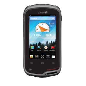
GPS Garmin monterra

Gambar
Rp Hubungi Kami @ Garmin Monterra merupakan bagian dari pengembangan Montana dan Android smartphone namun tanpa fungsi telepon seluler. Monterra menghadirkan navigator GPS dengan fitur lengkap yang menggabungkan pemetaan powerful dengan fleksibilitas dari sistem operasi Android. Monterra menyediakan profesional outdoor dengan kemampuan utama untuk menyesuaikan perangkat GPS secara sempurna sesuai dengan kebutuhan pribadi dan profesional. Fitur-fitur Menarik pada Garmin Monterra: 1. Penggabungan Pemetaan 3D Monterra adalah alat pemetaan utama dengan fungsi pemetaan 3D. Gabungkan 2 peta, misalnya TOPO dan Birdseye Citra Satelit, kemudian melihat kedua peta dalam format 3-D. Anda akan melihat tekstur yang lengkap, seperti bukit, lembah, danau dan hutan. Zoom in, pan dan memutar peta 3-D menggunakan multi-touch. 2. Foto berkualitas Monterra dilengkapi dengan kamera digital 8 megapixel autofocus yang dapat mengambil gambar secara jelas, geo-tagged foto, ditambah kamera video HD 1080p denga

Altimeter Brunton Nomad G30

Gambar
Rp Hubungi Kami @   Jual Altimeter Brunton Nomad G30 di Makassar Easy to calibrate, forward bearing digital compass provides accurate headings at the push of a button, plus exercise pacers, timers, and temperature gauges keep you up to speed on your performance and environment. With daily alarms and a backlit display, the latest generation of the proven Nomad series makes sure you stay on course in deep woods or after the sun goes down.     Backlit digital display     Declination adjustable     Forward bearing compass reads degrees and cardinal directions     Altimeter with 1ft/ meter resolution     Barometric pressure in Hg or mB     1° resolution     Temperature display in Celsius or Fahrenheit     Time and date display     Daily alarms     1 CR2032 battery included     Wrist/neck lanyard     3.5”x2.25”x0.75″     2.3 oz

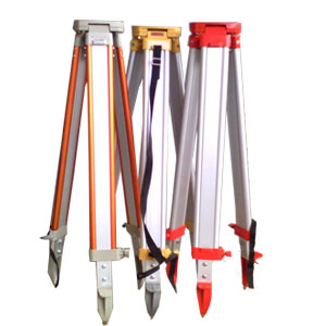
Alumunium tripod

Gambar
Rp Hubungi Kami @ Alumunium Tripod Sokkia, Nikon, Topcon for Total Station, Theodolite Digital, Automatic Level

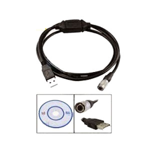
Cable Data Total station Sokkia, Nikon dan Topcon

Gambar
Rp Hubungi Kami @ Jual Cable Data Total station Sokkia,Cable Data Total station Nikon,Cable Data Total station Topcon di Makassar  

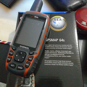
Jual gps garmin di makassar

Gambar
Jual gps garmin 78s di Makassar. Jual gps garmin 64s di Makassar. Jual gps garmin etrex 10 di Makassar. Jual gps garmin etrex 30x di Makassar. Jual gps garmin Montana 680 di Makassar. Jual gps garmin Monterra di Makassar.

Laser Distance Meter Leica Disto X310

Gambar
Rp Hubungi Kami @ Jual leica disto X310 Laser Distance Measurer Specifications : •Distance measurement up to 120 m •Minimum / maximum measurements •Triangle / room angle function •Area / volume measurements •Painter function •Pythagoras functions •Tilt measurement 360° •Smart Horizontal Mode™ •Height tracking •Stake-out function a/b •Subtraction / addition •Timer Kelengkapan : 1x Manual Book 1x Software

Theodolite digital ruide ET-02

Gambar
Rp Hubungi Kami @ Theodolite Ruide ET02 Theodolite Ruide ET02 harga sangat murah tapi berkualitas sangat cocok untuk survey konstruksi. Akurasi sampai 2 detik. Batere tahan sampai 10 jam. layar cerah dan lebar sehingga bisa menampilkan informasi data dengan jelas.  Spesfikasi : - Bayangan  : Tegak - Pembesaran : 30X - Apperture : 45 mm - Display : dual face - AKurasi :  2 detik - bacaaan terkecil : 1 detik - Ketahanan batere : 10 jam Kelengkapan Standar: 1x Alumunium Tripod

Automatic level topcon AT-B4

Gambar
Rp Hubungi Kami @   Jual automatic level / waterpass topcon AT-B4 di makassar AT-B Series Features:     •    Durable, Dependable, High Value Auto Levels     •    3 Models - 32x, 28x, and 24x Magnifications     •    Rapid, Accurate, and Stable Automatic Compensation     •    Ultra-Short 20cm (7.9 in.) Focusing     •    All-Weather Dependability     •    Clampless, Endless Fine Horizontal Adjustments SPESIFICATION Accuracy   +/-0.08"  100 Ft. Aperture   1.2" Characteristics   Waterproof, Dustproof, 1:100 Stadia Lines Field of View   1 Deg 30'' Includes   Hard Shell Carry Case, Plumb Bob, Weather-Protective Bag,Lens Cleaning Cloth, Hex Key Item   Optical Level Leveling Type   Mylar Suspended w/Magnetic Dampening Magnification   24x Minimum Focus   1.6 ft. Mounting Thread   5/8-11 SKUs    4XRD4 Type    Auto-Leveling UPC    094706715733 Vertical Range    Level Weight    7.90 Working Range   Unlimited Kelengkapan Standar: 1x Alumunium Tripod 1x Rambu Ukur 3M
GPS Garmin Oregon 650

Gambar
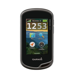
Rp Hubungi Kami @   More Features, More Satellite Power Behind a Tough, Bright Touchscreen     3" sunlight-readable touchscreen display with dual orientation     8 MP autofocus camera with LED flash/torch     Worldwide basemap with shaded relief     3-axis compass with accelerometer and barometric altimeter sensors     Dual battery system — 2 AA batteries or included rechargeable internal NiMH pack Spesifikasi  Physical & Performance: Physical dimensions    2.4" x 4.5" x 1.3" (6.1 x 11.4 x 3.3 cm) Display size, WxH      1.5"W x 2.5"H (3.8 x 6.3 cm); 3" diag (7.6 cm) Display resolution, WxH        240 x 400 pixels Display type    transflective color TFT touchscreen Weight            7.4 oz (209.8 g) with batteries Battery            rechargeable NiMH pack (included) or 2 AA batteries (not included); NiMH or Lithium recommended Battery life      16 hours Water rating    IPX7 Floats No High-sensitivity receiver         Yes Interface          high-spe

GPS Garmin montana 680

Gambar
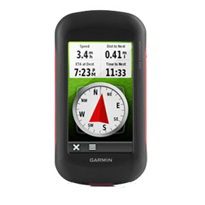
Rp Hubungi Kami @ GPS/GLONASS yang kokoh dengan Kamera 8 Megapiksel dan Berlangganan Birdseye •    Tampilan layar sentuh orientasi ganda 4 inci yang dapat dioperasikan meskipun mengenakan sarung tangan •    Kamera fokus otomatis ‧8 megapiksel; secara otomatis memberi geotag pada foto •    Melacak baik satelit GPS maupun GLONASS •    1 tahun berlangganan BirdsEye Satellite Imagery •    Kompas elektronik 3-sumbu dan altimeter barometrik Bawalah saat mendaki. Bawalah saat berburu. Bawalah saat berada di air. Montana 680 dilengkapi layar sentuh berwarna orientasi ganda yang dapat digunakan meskipun menggunakan sarung tangan termasuk 1 tahun berlangganan BirdsEye Satellite Imagery. Kamera digital menyajikan gambar berkualitas tinggi, resolusi yang unggul dan secara otomatis memberi geotag pada foto dengan koordinat. Perangkat genggam ini dilengkapi kompas berkompensasi kemiringan 3-sumbu, altimeter barometrik dan akses ke satelit GPS maupun GLONASS untuk meningkatkan penentuan posisi dan bi

Total station cygnus KS-102P

Gambar
Rp Hubungi Kami @ Jual  sewa service kalibrasi Total station cygnus KS-102P Specifacation Total station cygnus KS-102P Magnifications: 30X Accuracy: 2” Measuring Range: With Single Prisma: 2,300m Display: 2 Display, Graphic LCD, Data storage: Internal Memory; 24,000 pts Size With Handle: 336(H) x 184(W) x 172(L) mm Weight With Battery: Apporx 4,8Kg Battery: BT-77Q ( Li-Ion Rechageable Battery ) Operating Time: Approx. 39 hours Kelengkapan Standar Total station cygnus KS-102P: 2x Alumunium Tripod 1x Pole Stik Prisma 1x Prisma Polygon 1x Prisma Single Tempat penjual total station cygnus Ks-102P di Makassar, Tempat penjual total station cygnus Ks-102P di Kendari, Tempat penjual total station cygnus Ks-102P di Mamuju, Tempat penjual total station cygnus Ks-102P di Manado, Tempat penjual total station cygnus Ks-102P di Gorontalo, Tempat penjual total station cygnus Ks-102P di Bitung, Tempat penjual total station cygnus Ks-102P di Palopo, Tempat penjual total station cygnus Ks-102P d

Total Station HI-Target ZTS-320R

Gambar
Rp Hubungi Kami @ Jual sewa service kalibrasi Total Station HI-Target ZTS-320R Specifacation Total Station HI-Target ZTS-320R Kelengkapan Standar Total Station HI-Target ZTS-320R : 2x Alumunium Tripod 1x Prisma Single 1x Prisma Polygon 1x Prisma Single 1x Pole Stik Prisma